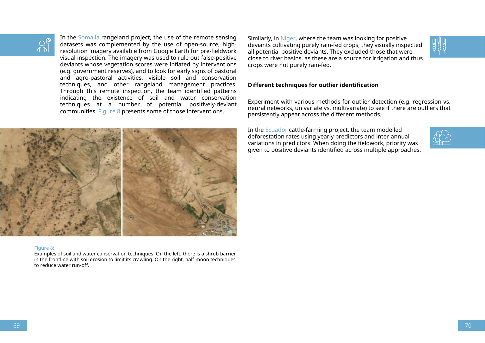
Similarly in Niger where the team was looking for positive deviants cultivating purely rain fed crops they visually inspected all potential positive deviants They excluded those that were close to river basins as these are a source for irrigation and thus crops were not purely rain fed In the Somalia rangeland project the use of the remote sensing datasets was complemented by the use of open source high resolution imagery available from Google Earth for pre fieldwork visual inspection The imagery was used to rule out false positive deviants whose vegetation scores were inflated by interventions e g government reserves and to look for early signs of pastoral and agro pastoral activities visible soil and conservation techniques and other rangeland management practices Through this remote inspection the team identified patterns indicating the existence of soil and water conservation techniques at a number of potential positively deviant communities Figure 8 presents some of those interventions Figure 8 Examples of soil and water conservation techniques On the left there is a shrub barrier in the frontline with soil erosion to limit its crawling On the right half moon techniques to reduce water run off Experiment with various methods for outlier detection e g regression vs neural networks univariate vs multivariate to see if there are outliers that persistently appear across the different methods Different techniques for outlier identification In the Ecuador cattle farming project the team modelled deforestation rates using yearly predictors and inter annual variations in predictors When doing the fieldwork priority was given to positive deviants identified across multiple approaches 69 70

Hinweis: Dies ist eine maschinenlesbare No-Flash Ansicht.
Klicken Sie hier um zur Online-Version zu gelangen.
Klicken Sie hier um zur Online-Version zu gelangen.